Introducing TerraScope Maritime: global vessel tracking that automatically identifies trends, detects anomalies, and anticipates behaviors.
Learn More »

At its core, Privateer Elements is a flexible platform that combines satellite data and AI-driven analysis with the adaptability to serve specific industries. How it works for you depends on your world: our tools shape-shift to fit your priorities, not the other way around.
Uncover market signals and manage risk with geospatial data that tracks real-world activity across supply chains, infrastructure, and climate exposure.
Explore solutions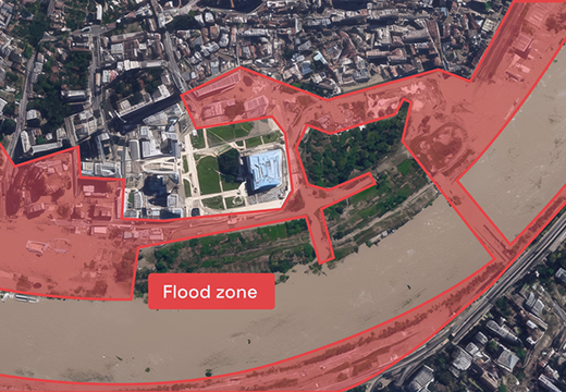
Gain operational awareness across land, sea, air, and space with mission-ready data and tools built to support planning, monitoring, and response.
Explore solutions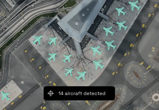
Integrate geospatial insight directly into your ERP workflows to improve forecasting, logistics, and asset visibility at global scale.
Explore solutions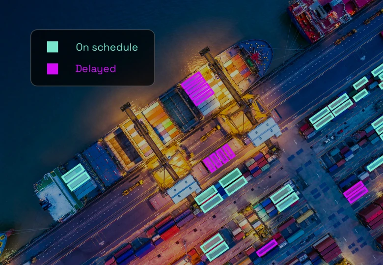
Track upstream, midstream, and downstream activity with geospatial data that helps you monitor assets, optimize operations, and reduce risk.
Explore solutions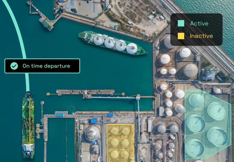
Not seeing exactly what you need? Let’s talk about how we can customize our solution to meet your goals.
Contact Us